
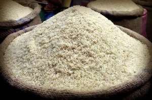
The government has identified about 515,000 hectares of land currently under rice cultivation through a satellite-based mapping exercise aimed at boosting investment in Ghana's rice sector and advancing the country's quest for self-sufficiency in rice production.
Speaking at the West Africa Rice Investment Roundtable in Accra on June 2, 2026, the Minister for Food and Agriculture, Eric Opoku, said the initiative is intended to provide investors with reliable data and reduce uncertainty associated with agricultural investments.
According to the Minister, the government has deployed advanced geospatial mapping technology to identify and assess rice suitable lands across the country. The exercise is also helping to organise production zones into clusters while evaluating water resources and irrigation potential.
“We have commissioned advanced satellite-based geospatial mapping to identify, delineate and characterize rice suitable land nationwide,” Mr Opoku said.
He explained that the programme is designed to determine the total land area required for Ghana to achieve rice self-sufficiency while generating detailed information on field boundaries, existing cultivation patterns and production potential.
“Initial findings from the exercise indicate that about 515,000 hectares of land are already under rice cultivation across the country's rain-fed lowland, irrigated lowland and inland valley production systems,” he stated.
Mr Opoku noted that the data generated from the exercise provides investors with a clearer picture of opportunities within Ghana's rice value chain.
“What this means for the partners and investors in this room is straightforward. We are no longer offering you vague potential. We are offering verified, location specific investment opportunities,” he said.
He added that access to accurate information on land location, ecological conditions and productivity gaps would enable investors and financial institutions to make better informed decisions while reducing risks associated with agricultural financing.
“Land we can point to on the map, with its ecology characterized and its productivity gap quantified,” he added.
Beyond identifying investment opportunities, the Minister said the satellite infrastructure will support the monitoring of crop growth and seasonal yield estimation, enhancing transparency and accountability within the sector.
According to him, the ability to track performance using credible data will strengthen investor confidence and improve access to financing for rice production and processing projects.
“Because the same satellite backbone allows us to monitor crop development and estimate yields season by season, it gives investors and financiers something they rarely have in smallholder agriculture — transparency and a credible basis for tracking performance,” he said.
Mr Opoku described the initiative as a major step toward making Ghana's rice expansion agenda more attractive to private sector investment.
He stressed that attracting investment remains critical to the government's efforts to reduce rice imports, increase domestic production and strengthen national food security.
“This is how we make a national rice expansion programme bankable,” he concluded.
 Mussa Dankwah urges ministers to focus on performance amid MoFA–finance minister...
 Selling single cigarette sticks illegal – FDA
 Hungry, unhealthy workforce cannot protect nation’s health – GRNMA
 Health Minister orders suspension of KATH CEO over Emergency admissions directiv...
 Our expenditure ceiling for first half of 2026 was capped at GH¢910 million - Ag...
 Agric Ministry refutes Finance Ministry’s GH¢1.6bn allocation claim
 NIA begins one-month mop-up Ghana Card registration for children in Volta, Oti r...
 Barekese Water Treatment Plant to be closed from June 9 - 11 for maintenance — G...
 Prioritize safety and security of nurses and midwives — GRNMA urges government
 Man who assaulted midwife at Tema Community 22 Polyclinic to face court on June ...

